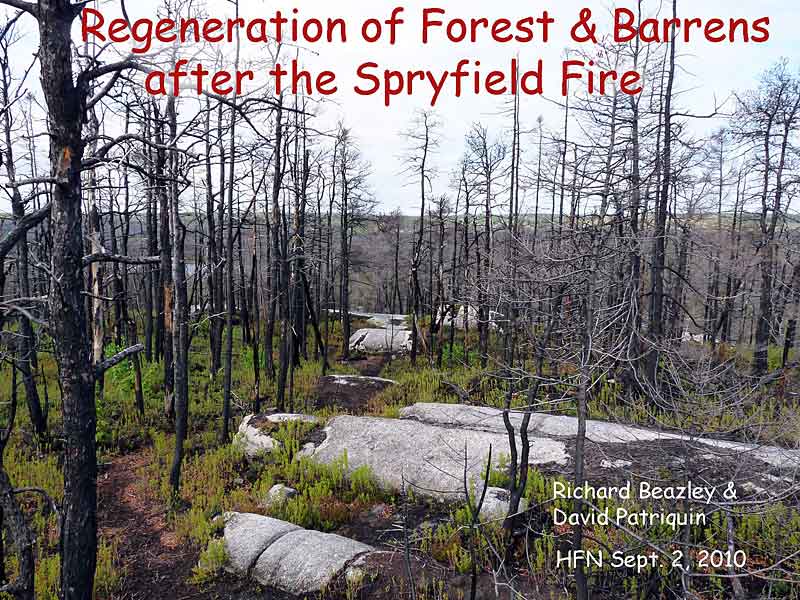
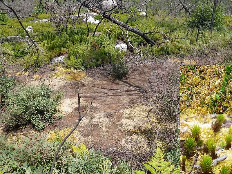
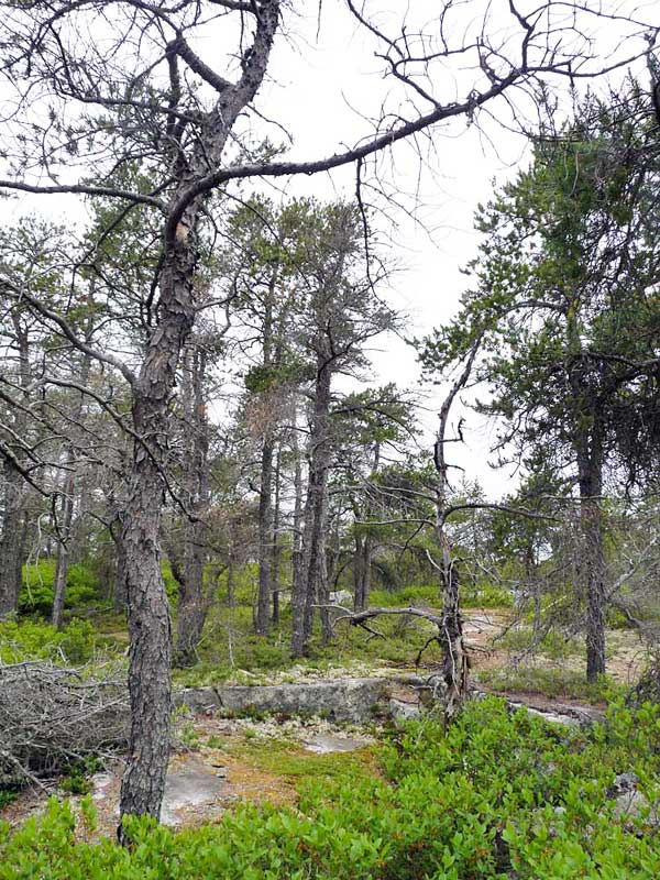
 Above: Barrens and associated pockets of forest overlooking Flat Lake on the Purcells Cove Conservation Lands, May 21, 2010. (Photo by David Patriquin)
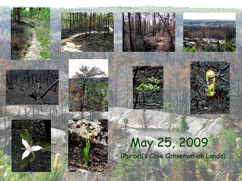
 | This set of photos illustrates the regeneration of vegetation over 16 months after an intense fire that swept through forest and barrens in the vicinity of Spryfield, Nova Scoita. The fire destroyed twelve homes.
The materials were prepared by Richard Beazley and David Patriquin for a talk given at a meeting of the Halifax Field Naturalists (HFN) on September 2, 2010. The text, with a few modifications to suit this format is taken from their report for the Halifax Field Naturalist (HFN's quarterly newsletter).
Richard, an outdoor and photography enthusiast, begins the presentation by providing a travelogue-like overview of the landscapes and views of some individual plant species as they began to regenerate after the fire. In turn, David, a retired biologist, examines the mechanisms by which plants regenerate after a fire and discusses some of the implications of living adjacent to or in fire-prone landscapes.
|
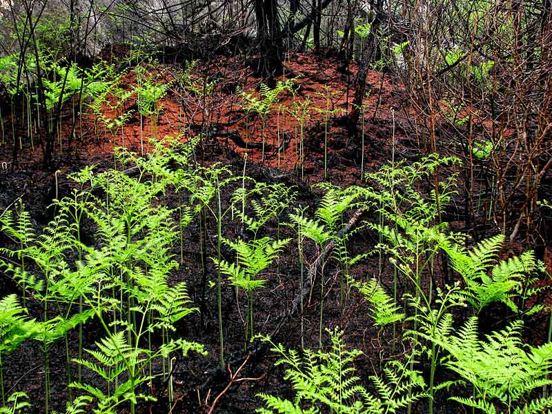
Above: bracken fern on a burned area of the Purcells Cove Conserations Lands, June 6, 2009. (Photo by Richard Beazley) |
2
Richard: "My interest in seeing and photographing the damage created by the fire and the later recovery was piqued by my initial sadness over the human-caused devastation of this wilderness habitat's fauna and flora, and later by the excitement of HFN members over the learning possibilities presented by the fire. Over 14 months, I visited the area seven times."
David: "To me it presented a special opportunity to observe the recovery of barrens and associated forest flora after a fire. I was particularly interested in two fire-stimulated species that occurred in the affected area: jack pine and broom crowberry."
|
 | 3
The Spryfield fire began on April 30th and burned for a couple of days into May
A nighttime photo of the fire taken by Ross O'Flaherty from Dartmouth showed a wall of flame above Halifax mainland south. (Special thanks to Ross for allowing us to use this photo.)
See posting on The Weather Network.
|
 | 4
The fire spread from its origin near Roach's Pond over a large area between the Purcells Cove and Herring Cove Roads extending southeast to just past York Redoubt.
The broken red line shows the approximate limits of the fire.
The white text and broken red line were superimposed on a Google Map for the area.
Each of us visited the Purcells Cove Conservation Lands and/or the Lower Mud Pond Area at one to two month intervals through the spring, summer and fall of 2009 and again in 2010. The Lower Mud Pond Area is more readily accessible than the burnt areas on the Purcells Cove Conservation Lands, but otherwise they are similar landscapes. |
 | 5
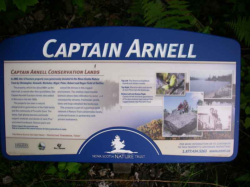
The Purcells Cove Conservation Lands lie in a 120 m wide strip extending from Purcells Cove Road to Flat Lake, 1.2 km inland.
HFN has a special interest in this area: we donated funds towards the land survey and legal processing of the Capt. Arnell Lands, the parcel initially donated to the Nova Scotia Nature Trust in 2003. In 2009, the Napier Family donated an adjacent strip (The Napier Family Conservation Lands), the two properties making up The Purcells Cove Conservation Lands.
HFN agreed to conduct a biological inventory of the Captain Arnell property (and now the combined properties), which has been an ongoing activity.
|
 | 6
May 25, 2009 in the Purcells Cove Conservation Lands
The next several photos, taken as one proceeds from Purcells Cove Road to Purcells Pond and beyond show what the area looks like when not burned. This photo shows the granitic bedrock, thin soil, and variety of small trees and bushy ground cover at the abandoned Purcells Cove rock quarry near Purcells Cove Road. (Photo by Richard Beazley) |
 | 7
May 25, 2009 in the Purcells Cove Conservation Lands
This photo illustrates the mixed forest around Purcells Pond, 500 m inland. (Photo by Richard Beazley) |

|
8
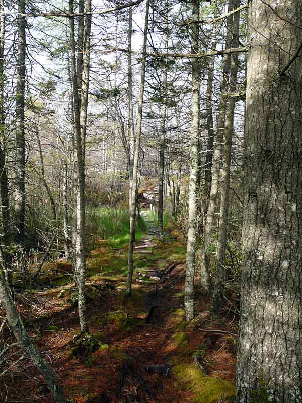
May 21, 2009 in the Purcells Cove Conservation Lands
This photo shows the high barrens and jack pine on the trail to Flat Lake just before you descend into a wetland and then climb into the burned area. (Photo by David Patriquin) |
 | 9
May 21, 2009 in the Purcells Cove Conservation Lands
Low-lying forest and wetland just before entering the burned area on the trail to Flat Lake. (Photo by David Patriquin) |
(Photos by Richard Beazley) |
10
Richard: I made my first post-fire visit to the Purcells Cove Conservation Lands on May 25th, 2009, three weeks after the fire. The fire had burned strips along and over granite outcrops and the barrens moving from the inland extremity of the Purcells Cove Conservation Lands at Flat Lake towards Purcells Pond. It did not burn some larger, lower lying wetland areas, one of which stopped its movement towards the Purcells Pond area and parts of the property closer to Purcells Cove Road. |

| 11
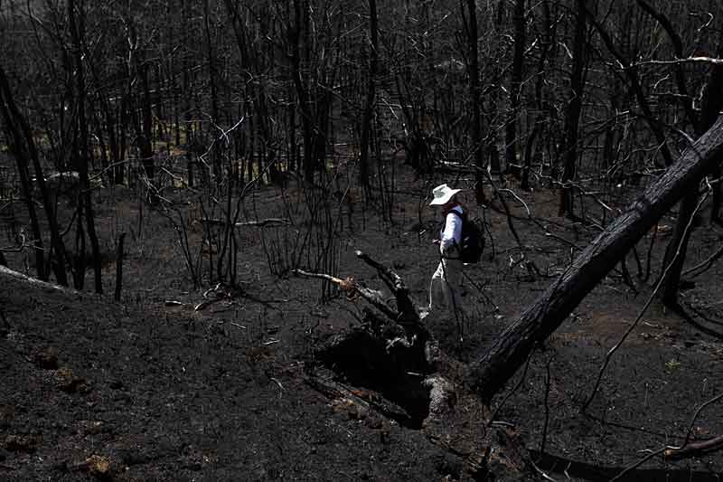
May 25, 2009 in the Purcells Cove Conservation Lands
Landscape scene as we enter the burned area. (Photo by Richard Beazley) |
 | 12
May 25, 2009 in the Purcells Cove Conservation Lands
Hiking trail in the burned area. (Photo by Richard Beazley) |
 | 13
May 25, 2009 in the Purcells Cove Conservation Lands
It appeared to be a totally devastated landscape. (Photo by Richard Beazley) |
 | 14
May 25, 2009 in the Purcells Cove Conservation Lands
Surrounded by tree skeletons and blackened soil without groundcover. (Photo by Richard Beazley) |
 | 15
May 25, 2009 in the Purcells Cove Conservation Lands
Life was already emerging from the thin, burned-over soil, as illustrated by this four-inch high (10 cm) bracken fern and a small painted trillium already in bloom (next photo). (Photo by Richard Beazley) |
 | 16
May 25, 2009 in the Purcells Cove Conservation Lands
Painted Trillium (Photo by Richard Beazley) |

(Photos by Richard Beazley) | 17
Richard: On the 6th of June 2009, a foggy day, I went back for a second visit. My photos show blackened tree skeletons, scorched jack pine needles, and 12- to 15- inch-high (30 - 40 cm) bracken fern, a pink lady's slipper, and six-inch-high (15 cm) saplings growing from the base of a burned red maple tree. I was heartened by the persistence of life exhibited so soon after the fire. |
 | 18
June 6, 2009 in the Purcells Cove Conservation Lands
Scorched jack pine needles
Bracken Fern
(Photo by Richard Beazley)
|
 | 19
June 6, 2009 in the Purcells Cove Conservation Lands
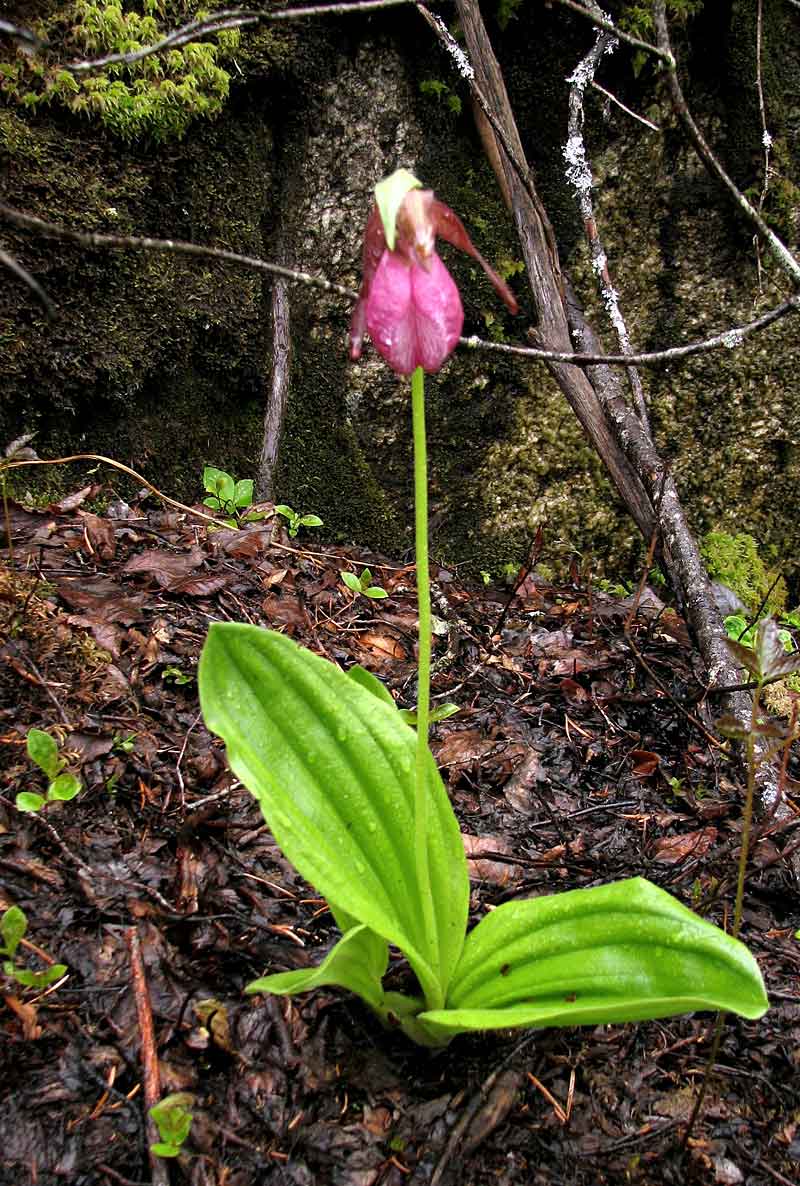
Pink Lady's Slipper (Photo by Richard Beazley) |
 | 20
June 6, 2009 in the Purcells Cove Conservation Lands
Six-inch-high (15 cm) saplings growing from the base of a burned red maple tree. (Photo by Richard Beazley) |
(Photos by Richard Beazley) | 21
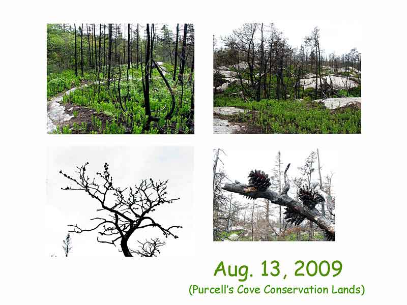
I next visited on August 13th, 2009, three months post-fire. |
 | 22
August 13, 2009 in the Purcells Cove Conservation Lands
This image illustrates both the surprising amount of growth in the huckleberry bushes and the impressive granite outcrops, some of which form rounded hills up to 100 meters high, often with steep sides. (Photo by Richard Beazley) |
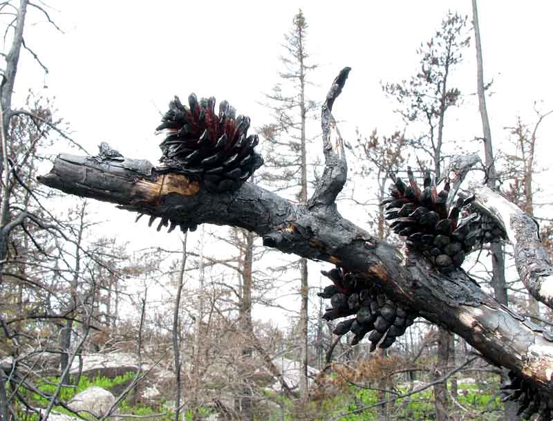 | 23
August 13, 2009 in the Purcells Cove Conservation Lands
Open cones of burned jack pine. (Photo by Richard Beazley) |
(Photos by Richard Beazley) | 24
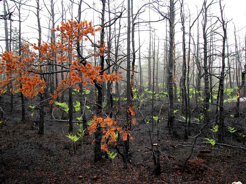
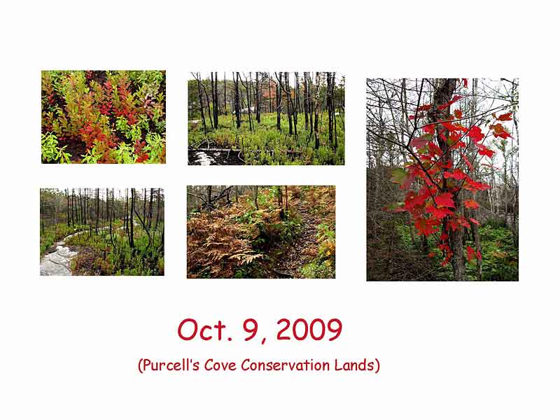
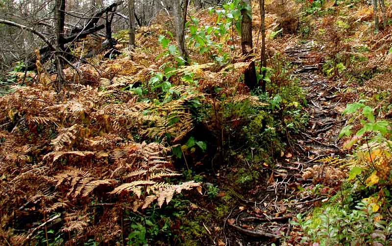
I made two visits in October, one on October 9th and the second on October 31st, five to six months post-fire. Images from my first visit showed leaves still green on wire birch, the beginning of color changes in huckleberry leaves, fern fronds turned brown, and suckers with fully reddened leaves on an otherwise lifeless-looking red maple tree. |
 | 25
October 9, 2009 in the Purcells Cove Conservation Lands
The beginning of color changes in huckleberry leaves. (Photo by Richard Beazley)
|
 | 26
October 9, 2009 in the Purcells Cove Conservation Lands
Fern fronds turned brown. (Photo by Richard Beazley) |
 | 27
October 9, 2009 in the Purcells Cove Conservation Lands
Suckers with fully reddened leaves on an otherwise lifeless-looking red maple tree. (Photo by Richard Beazley) |
(Photos by Richard Beazley) | 28
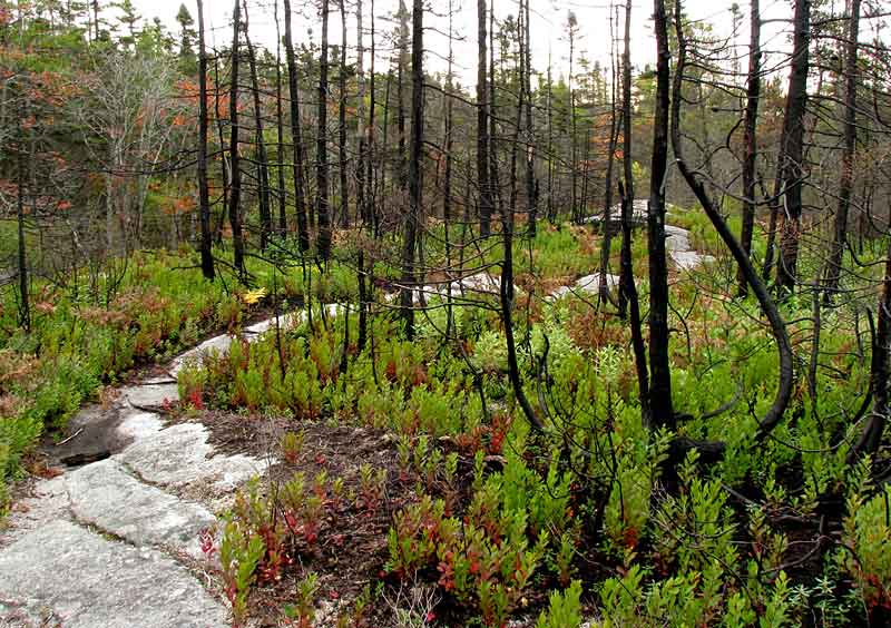
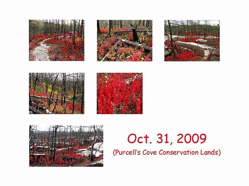
The images I shot three weeks later recorded huckleberry leaves in their brilliant red color, a hillside scene with a variety of tree growth and ground cover in varying degrees of color change. One scene shows striking sweeps of fire-engine red huckleberry below blackened tree trunks. |
 | 29
October 31, 2009 in the Purcells Cove Conservation Lands
(Photo by Richard Beazley) |
 | 30
October 31, 2009 in the Purcells Cove Conservation Lands
(Photo by Richard Beazley) |
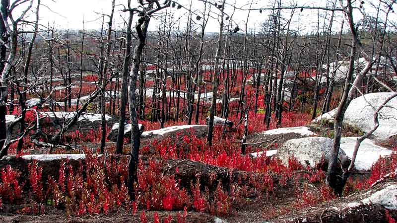 | 31
October 31, 2009 in the Purcells Cove Conservation Lands
Sweeps of fire-engine red huckleberry below blackened tree trunks; David said it looked as if the area had been reignited as a surface fire. (Photo by Richard Beazley) |

(Photos by Richard Beazley) | 32
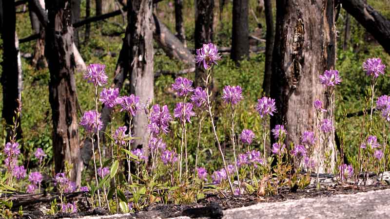
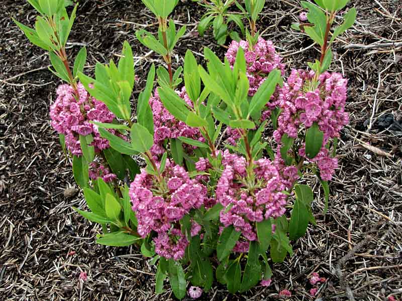
My first visit in 2010 was on May 18th, one year post-fire. Not surprisingly, one distant image showed the area looking lifeless, much like it had a year earlier, but on closer inspection new growth was abundant, giving evidence to nature's persistence. There were 12-inch-high (30 cm) new sprouts of rhodora, each with one flower, blueberry plants and shadbush in blossom, and three-foot high wire birch. |
 | 33
May 18, 2010 in the Purcells Cove Conservation Lands
(Photo by Richard Beazley)
|
 | 34
May 18, 2010 in the Purcells Cove Conservation Lands
12-inch-high (30 cm) new sprouts of rhodora, each with one flower. (Photo by Richard Beazley) |
 | 35
May 18, 2010 in the Purcells Cove Conservation Lands
Three-foot high sprouts of wire birch. (Photo by Richard Beazley) |
 | 36
May 18, 2010 in the Purcells Cove Conservation Lands
Blueberry in bloom. (Photo by Richard Beazley) |
 | 37
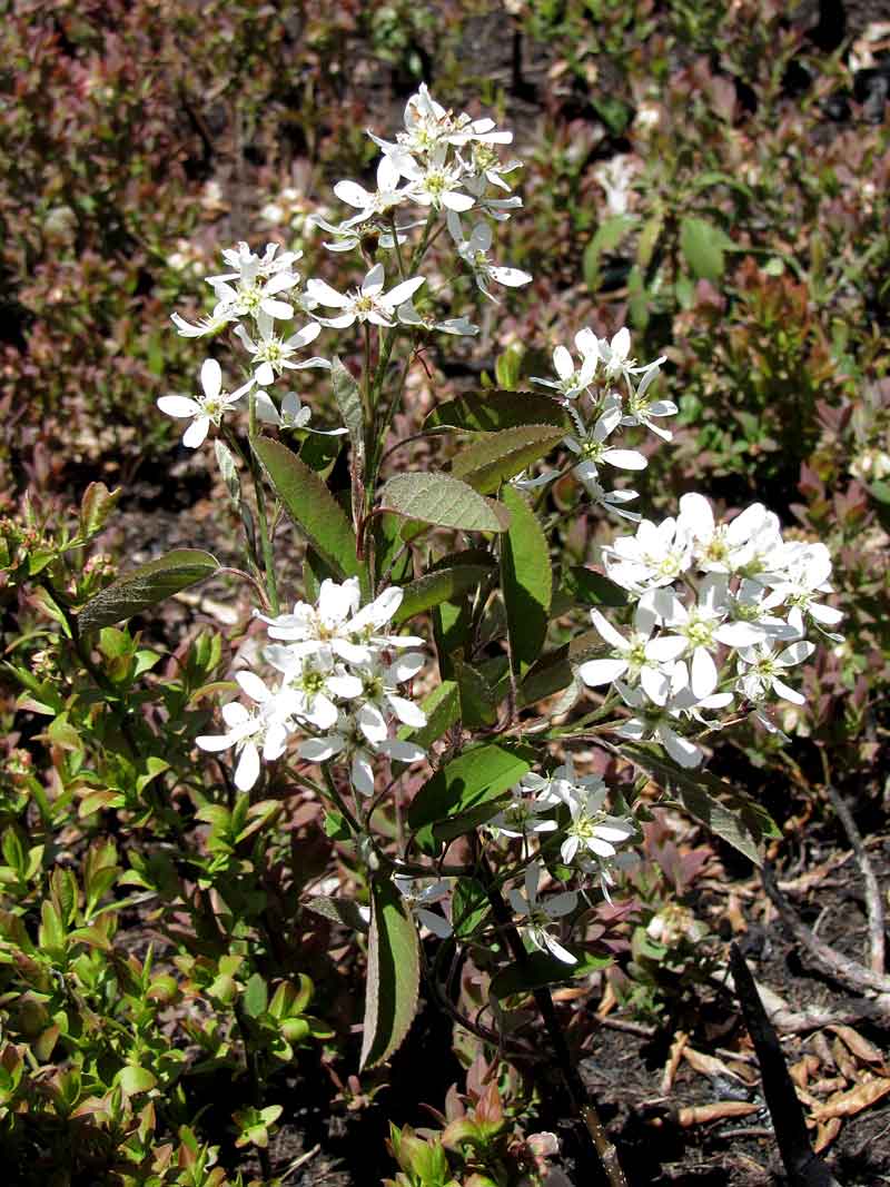
May 18, 2010 in the Purcells Cove Conservation Lands
Shadbush in bloom. (Photo by Richard Beazley) |
(Photos by Richard Beazley) | 38
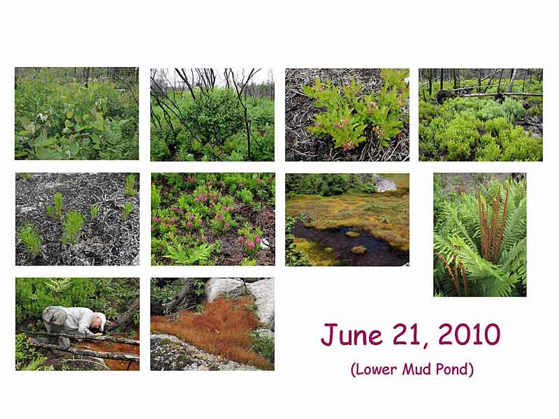
On the 21st of June 2010, 13 months post-fire, I visited the Lower Mud Pond area with David. My images from that day show much second-year growth: four-feet-high (1.2 m) large-toothed aspen, two-feet-high (60 cm) huckleberry and rhodora bushes, profusely spreading and flowering lambkill, blueberry bushes with green fruit, and four-inch-high (10 cm) jack pine seedlings. I concluded my part of the presentation by showing an unburnt wetland that lies adjacent to burnt forest near York Redoubt and highlighted the value of wetlands in limiting spread of the fire and in protecting the flora and fauna. |
 | 39
June 21, 2010 in the Lower Mud Pond area
Large-toothed aspen sprouts, four-feet-high (1.2 m) (Photo by Richard Beazley) |
 | 40
June 21, 2010 in the Lower Mud Pond area
Two-feet-high (60 cm) huckleberry and rhodora sprouts. (Rhodora sprouts make up the softer coloured patch in the middle of the photo.) (Photo by Richard Beazley) |
 | 41
June 21, 2010 in the Lower Mud Pond area
Profusely spreading and flowering lambkill. (Photo by Richard Beazley) |
 | 42
June 21, 2010 in the Lower Mud Pond area
Four-inch-high (10 cm) jack pine seedlings. (Photo by Richard Beazley) |
 | 43
June 21, 2010 in the Lower Mud Pond area
Blueberry bushes with green fruit. (Photo by Richard Beazley) |
 | 44
June 21, 2010 in the Lower Mud Pond area
An unburnt wetland that lies adjacent to burnt forest near York Redoubt. The fire did not cross the wetland. (Photo by Richard Beazley) |
 | 45
June 21, 2010 in the Lower Mud Pond area
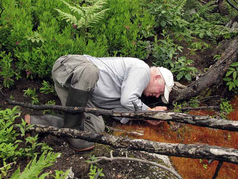
David gets a close-up look at purple horn toothed moss , Ceratodon pupureus, growing in a burnt area of forest near York Redoubt. It's sometimes called Fire Moss. (Photo by Richard Beazley) |
(Photos by David Patriquin) | 46
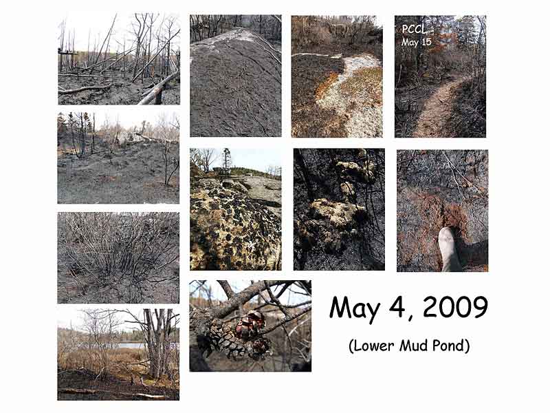
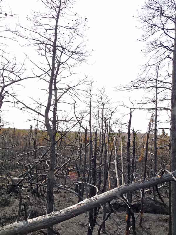
David: I went to the Lower Mud Pond area on May 4th, 2009, to view the forest and barrens as soon after the fire as possible. In a word: black! The soil surface and all above-ground vegetation were uniformly charred and most of the finer branches of trees had burned off completely. When I brushed the blackened soil surface, brown peaty soil was revealed a few millimeters below. There was a stubble of burned off huckleberry stems where once extensive and vigorous plants had stood 1 to 4 or more feet (30 -120 cm) high. The fire had stopped abruptly at the leatherleaf stands surrounding Lower Mud Pond. However, smaller wetlands were affected; most striking were the mats of sphagnum which were bleached or browned, evidently killed but not burned. I was very excited to see what I had hoped to see: the serotinous cones of jack pine had opened and were releasing their seed into the wind. I could even see them on the soil surface.
The photo at top right is on the trail into Flat Lake on the Purcells Cove Conservation Lands. Well-used footpaths were not charred by the fire. |
 | 47
May 4, 2009 in the Lower Mud Pond area
At left: Needles had burned off on jack pines in the foreground; cones remained but were charred and had opened. There is unburned forest in the background. (Photo by David Patriquin)
Three major categories of forest fires are commonly described: Ground fires are mostly smoldering combustion of compacted duff or peat, with little flaming. A ground fire may creep only a few feet per day through the thick forest floor duff under a shady coastal forest. Surface fires burn above the ground in leaves, grasses and herbs, shrubs, and downed woody debris. Crown fires spread through the canopies of trees by torching out trees as the surface fire ignites them from below or by spreading through tree canopies independently of the surface fire. Crown fires are usually driven by strong winds or aided by steep slopes. (SOURCE: Arno, F. & Allison-Bunnell, S. 2003. Flames in Our Forest: Disaster or Renewal? Island Press.)
The Spryfield fire was a surface and canopy fire over most of the affected area, killing most everything above ground. As shown by Richard's photos, there was evidently a lot belowground that wasn't killed.
|
(Photos by David Patriquin) | 48
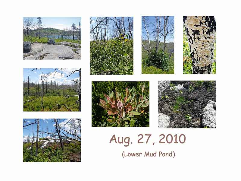
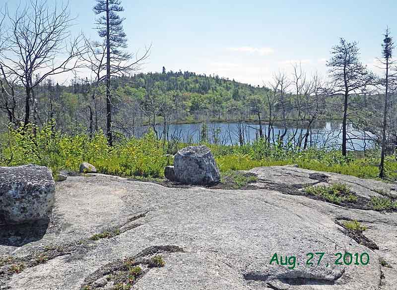
Aug. 27, 2010 in the Lower Mud Pond area
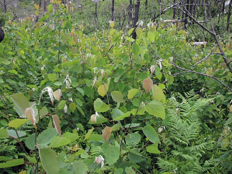
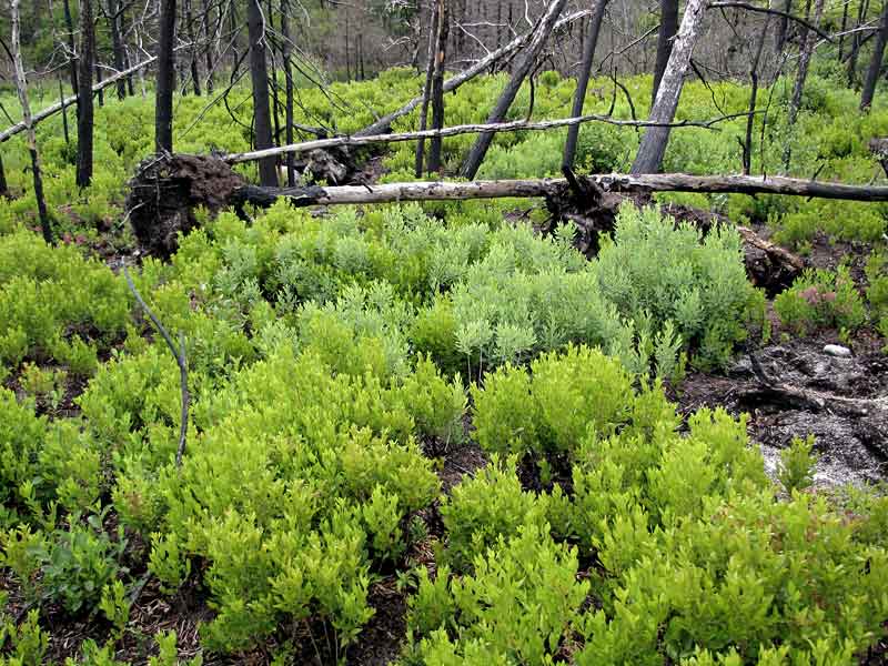
On my most recent visit to Lower Mud Pond (August 27th, 2010), only 16 months after the fire, there was a blanket of leafy vegetation over the previously treed areas, reaching 2 m high in places. On the more open barrens areas, huckleberry, rhodora, lambkill and blueberry had returned to close to their previous heights and were already producing fruit.
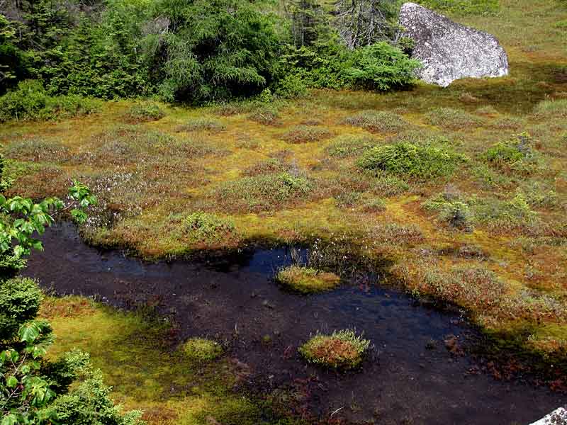
The areas slowest to revegetate have been (i) small wetlands which were burned over or heat damaged (fire did not penetrate far into larger wetlands) and (ii) areas where mats of broom crowberry had occurred on the open barrens.
|
 | 49
Aug. 27, 2010 in the Lower Mud Pond area
In places on small fire-damaged damaged wetlands, cranberry and hairy cap moss were growing over the still largely dead mats of sphagnum moss; there were a few spots where sphagnum appeared to be regrowing again. (Photo by David Patriquin)
|
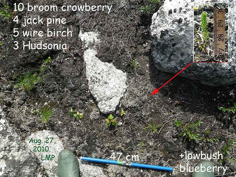
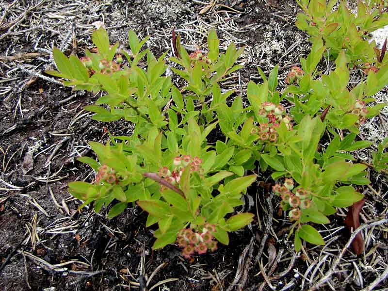
Seedlings on Old Broom Crowberry Ground
On August 27th, clusters of very small broom crowberry seedlings were observed at several sites, but not at most sites where there had been mats of broom crowberry before the fire. At the site shown above, seedlings of jack pine, wire birch and hudsonia (goldenheather) were also present and a blueberry plant which had grown up from rhizomes. Exposed, fire-killed rhizomes of broom crowberry can be seen to the left of the large rock. Post-talk note:: By the end of September, 2010, broom crowberry seedlings could be found at most sites where there had been plants before the fire. | 50
Aug. 27, 2010 in the Lower Mud Pond area
The extensive areas where broom crowberry had previously thrived remained largely bare on Aug 27th, 2010.
Broom crowberry, a creeping shrub with evergreen, needle like leaves, is commonly found on granitic outcrops in the area of the shallowest soils between bare rock and huckleberry stands; it's often mixed with reindeer lichen and extends into the outer fringes of huckleberry stands. In places, fire and/or subsequent erosion had removed the thin soil and litter, exposing old burnt rhizomes. There was no sign of new growth from rhizomes after the fire but on August 27th I observed, for the first time, a few areas with broom crowberry seedlings.
(Photo by David Patriquin)
|
 | 51
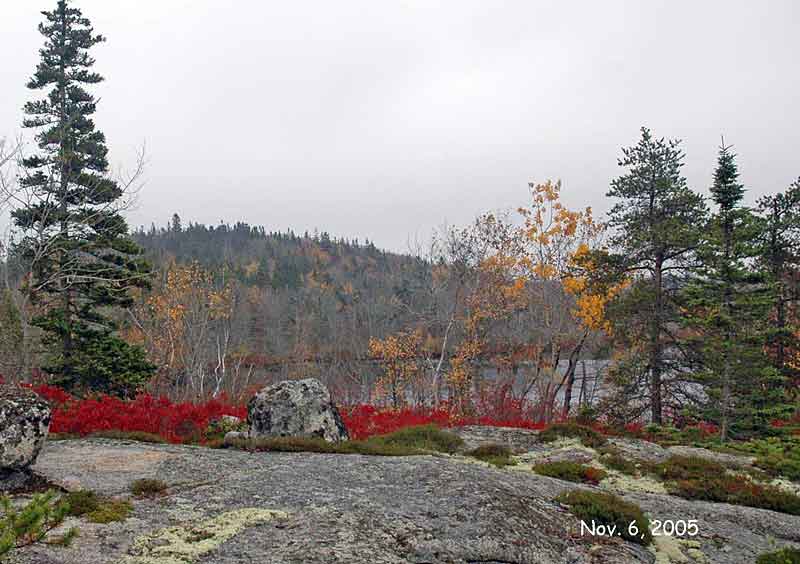
Nov. 6, 2005 in the Lower Mud Pond area
A Recap
This photo overlooking Lower Mud Pond and the next two were taken from the same vantage point.
The photo at left was taken in mid fall several years before the fire. The red shrub is huckleberry. The deciduous trees are large-toothed aspen, wire birch and American mountain ash. The conifers are black spruce and jack pine. The creeping vegetation on the rocks is made up mostly of broom crowberry, there is some three-toothed cinquefoil; white patches are reindeer lichen. (Photo by David Patriquin) |
 | 52
May 4, 2009 in the Lower Mud Pond area
A few days after the fire: creeping vegetation was charred except at its fringes; all else in the foreground (bushes, trees) was well charred. The fire moved from this area towards the lake (Lower Mud Pond, stopping at the wetland surrounding the lake. (Photo by David Patriquin) |
 | 53
Aug. 27, 2010 in the Lower Mud Pond area
Sixteen months after the fire, huckleberry is close to its previous stature, sprouts of large-toothed aspen, wire birch and American mountain ash are several feet (1 m) tall. Three-toothed cinquefoil has grown up from rhizomes but broom crowberry has not; closer inspection reveals the first seedlings of broom crowberry. (Photo by David Patriquin) |
(Photos by David Patriquin) | 54
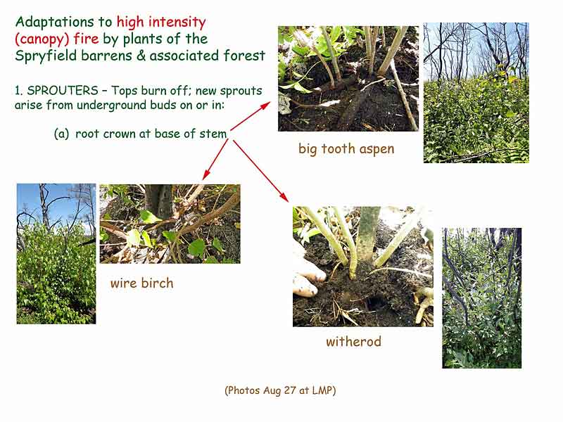
Aug. 27, 2010 in the Lower Mud Pond area
Ecologists talk about "life history strategies", which are the features of how a species grows and reproduce that enable it to be adapted to a particular set of environmental conditions.
Three categories of life history strategies adapted to canopy level fires are illustrated by species we have seen in the photos:
- species regenerating from buds (sprouters),
- species regenerating from above-ground seedbanks,
- species regenerating from below-ground seedbanks .
The rapidly regenerating vegetation viewed in previous photos consisted of deciduous species that regenerate from buds on the root crown, roots or rhizomes when current top growth is removed or damaged by disturbances such as cutting, grazing or fire. |
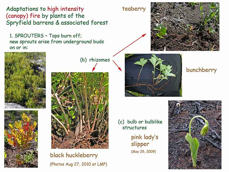
(Photos by David Patriquin) | 55
Aug. 27, 2010 in the Lower Mud Pond area
Species regenerating from buds on the root crown, roots or rhizomes at Lower Mud Pond and on the Purcells Cove Conservation lands include trees (red maple, white and wire birch, large-toothed aspen and shadbush), larger shrubs (witherod, mountain holly, Canada holly, alder) and smaller shrubs (huckleberry, rhodora, lambkill, blueberry).
Orchids (bottom right) and lilies regenerate from bulbs or bulblike structures. |
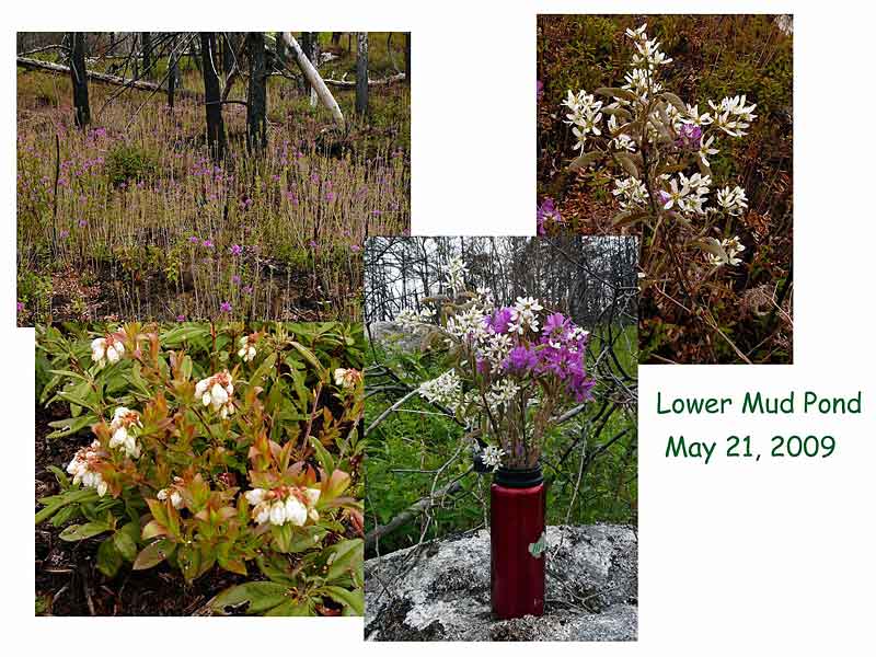 | 56
May 21, 2010 in the Lower Mud Pond area
Remarkably, many of the sprouts produced flowers in 2010. My "hiker's bouquet" consisted of flowering sprouts of rhodora and shadbush. (Photos by David Patriquin)
|

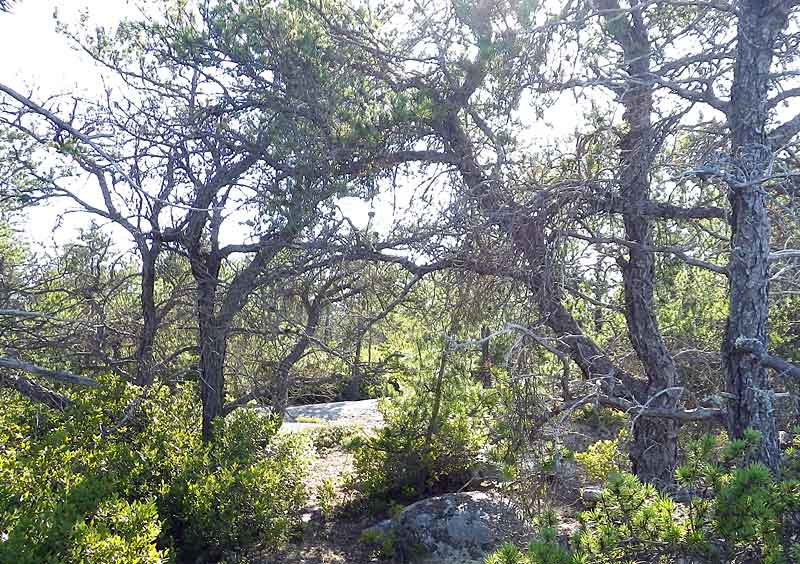
Granite is very hard and impermeable with few fissures, resulting in shallow rooting. quick surface drainage and droughtiness on sloping and elevated areas, and accumulation of water in depressions. Trees grow to larger sizes only where there are pockets or larger patches of soil/glacial till. Jack pine generally occurs on better drained sites (or microsites), black spruce in more poorly drained sites. | 57
Oct. 2, 2007 in the Lower Mud Pond area
Regenerating from "Above-ground Seedbanks": the Fire Adapted Conifers
Two conifers - jack pine and black spruce - were common in the burned areas prior to the fire. Both are boreal species, well adapted to recurrent stand-replacing canopy fires which are normal in the boreal forest. They survive by producing "above-ground seedbanks".
In the photo at left a large jack pine stands in the centre background, other smaller jack pines and black spruce trees of varying height elsewhere. In the foreground, huckleberry and broom crowberry occur on thin soils bordering exposed granitic rock (or rock covered with only lichens and mosses). (Photo by David Patriquin)
|

Black spruce is not so extreme in its adaptations; it produces semi-serotinous cones which stay on a tree for several but not many years. As noted above, I observed cones of jack pine to be open and releasing seeds within a few days of the fire. I also observed bunches of blackened black spruce cones on the ground and some still remaining attached on burnt trees. I observed only a few seedlings of jack pine in the fall of 2009, but they become quite common by the late summer of 2010. I have not yet (Aug. 27, 2010) seen seedlings of black spruce, but I may not be looking hard enough. Post-talk note: I found one in the Lower Mud Pond area a couple of weeks later. (Photos by David Patriquin) | 58
Jeffrey Danter summarizes fire adaptations of jack pine as follows:
Jack pine is well-adapted to fire. Serotinous cones, which have a waxy outer coating to protect the seeds, remain on the tree rather than dropping to the forest floor. Seeds can remain viable on the tree for 20 years or longer. When a fire occurs, the thick cone protects the jack pine seed from the intense heat. Jack pine seeds have been known to still be viable after exposure to heat at 1000 degrees Fahrenheit. That heat, however, opens the scales of the cone and releases the seed onto the ground where the fire has removed much of the existing vegetation and litter. jack pine seeds require contact with mineral soil to germinate, so fire serves to prepare the seedbed, reduce competition from other plants, and release the jack pine seed. In addition, the short stature of jack pines makes crown fires a high likelihood; these very crown fires are necessary to release the seeds from dormancy. (SOURCE: Danter, K.J. n.d. Fire Dependent Ecosystems of the United States)
|
|
Jack pine on granite outcrop area on Halifax south mainland, Aug. 19, 2010. (Photo by David Patriquin)
| 59
As well as being adapted to fire, jack pine is generally considered to be a "fire-dependent" species and thus it's presence in an area to be indicative of a history of recurrent fire. (Black spruce is not so fire dependent: it is longer lived than jack pine and is shade tolerant so is not so affected by competition as the shade-intolerant jack pine.)
Commonly cited intervals for fire in jack pine stands are in the range 25 to about 120 years. Seed production begins at 5 to 10 years, and if fires repeat at very short intervals, jack pine gives way to a treeless (barren) landscape. Jack pine rarely lives more than about 170 years and is generally replaced by other species after intervals of 200 to 300 years without fire.
|

(Photos by David Patriquin) | 60
Regenerating from below-Ground Seedbanks: Broom Crowberry & Co.
Broom crowberry (Corema conradii) is the pre-eminent example in our area of a species surviving fire through a below-ground (soil) seedbank. While the thin, shallow-lying rhizomes are readily killed by fire, seeds accumulate and survive in the soil and are stimulated to germinate by the heat or other effects of a fire. Martine et al.* reported that | a hot fire burned through one of the most extensive New Jersey populations of this state-endangered species during the summer of 2001, resulting in mortality of nearly all plants in the burned areas. Significant seedling recruitment occurred in the fall of 2002, followed by an even greater seedling emergence the following year. |
Established plants were likewise completely destroyed in burned areas of the May 4, 2009 Spryfield fire and I saw the first seedlings only in the late summer of 2010.
*Martine, C.T. et al. 2005. The biology of Corema conradii: natural history, reproduction, and observations of a post-fire seedling recruitment. Northeastern Naturalist 12(3):267-286. |

See NS Wild Flora Society: Corema conradii for more details. Inset map is from NatureServe Explorer page for Corema conradii. (Photos by David Patriquin) | 61
Broom crowberry is a coastal plain species that is threatened or endangered through most of its range in the eastern seaboard, except in Nova Scotia where populations are considered secure. It produces fleshy structures called elaisomes on its fruits that facilitate dispersal of seeds by ants. Martine et al. (cited above) comment that " throughout its range, C. conradii primarily occurs in habitats historically prone to fire".
|

Goldenheather in flower, June 20, 2009,
Inset map is from NatureServe Explorer page for Hudsonia ericoides). (Photo by David Patriquin) | 62
Goldenheather (Hudsonia ericoides is another coastal plain species and creeping shrub that occurs on shallow soils over granite and survives fire through an below-ground seedbank. As was the case for broom crowberry, I observed seedlings for the first time only in the late summer of 2010. They seem to get a bit of a jump start over the crowberry, however, as they were much larger thanthe crowberry seedlings, either germinating earlier (but unseen), and/or growing faster. |

Seedlings of several graminoids (grasses, rushes & sedges) were already numerous at some sites in the Purcells Cove Conservation lands in June of 2009. Pitcher plants grew up from rhizomes lying below heat-killed sphagnum in small wetlands. (Photos by David Patriquin) | 63
Some species not yet mentioned
Mountain sandwort: I observed flowering plants on the Purcells Cove Conservation Lands in September of 2009; these appeared to have regenerated from seed, rather than rhizomes.
Reindeer and other lichens: lichens were burnt to a crisp by the fire, and had hardly come back at all by August 27, 2010. However on that date, I observed what appeared to be young colonies of reindeer lichen in some of the broom crowberry areas.
Mosses I observed several small patches of hairy cap moss and broom moss on broom crowberry ground on Aug. 27, 2010. Richard and I observed a large and visually striking patch of purple horn toothed moss in ground in burnt forest near York Redoubt on June 21st, 2010.
Seedlings of wire birch and of a few weedy species, likely derived from outside sources, were observed in the fall of 2009 and subsequently in the open barrens and in the soil exposed where trees were uprooted during or after the fire.
|

(Photos by David Patriquin; see NS Wild Flora Society: Pinus banksiana for more details.)
| 64
Jack pine and fire in Nova Scotia
The precise relationship of jack pine to fire in Nova Scotia needs to be clarified through scientific study. In the boreal forest, most cones on jack pine are the closed serotinous type, but in Nova Scotia there is commonly a mixture of closed serotinous cones and cones that have opened without fire with one or the other often much more numerous according to the tree and site.
There may be some situations where disturbances and stresses other than fire are sufficient to maintain this shade intolerant species. However, it seems pretty likely that the abundance of jack pine, as well as broom crowberry, on the more exposed granitic landscapes of Halifax mainland south reflects a history of recurrent fire. |
Savannah-like Jack pine stand on Halifax mainland south, June 20, 2009. Ground vegetation consists mostly of huckleberry, broom crowberry, reindeer lichen. (Photo by David Patriquin) | 65
A local resident told me that the last big fire in the Lower Mud Pond Area occurred 45 years prior to the 2009 fire. At the HFN talk, Jill Alexander said the last big fire on the Captain Arnell property was in 1917. Certainly, fires have been common since the Europeans arrived. Before that, fires were likely less frequent but First Nations Peoples tended to settle mostly near the coast and also set fires deliberately or accidentally, and lightening can spark fires in these sorts of environments.
The important point, I think, is to recognize that areas with abundant jack pine as well as broom crowberry, are likely to have a history of recurrent fire and to be increasingly prone to fire as they age.
The accumulation of litter and debris on the forest floor over time increase the likelihood of moderate - or high-severity fire [in jack pine forests].. A lichen mat, a highly flammable and continuous fuel source at ground level, develops within 40 years and is important in supporting fires in jack pine forests. (SOURCE: Carey, J.H. 1993. Fire Effects Information System: Pinus banksiana, http://www.fs.fed.us/database/feis/) |
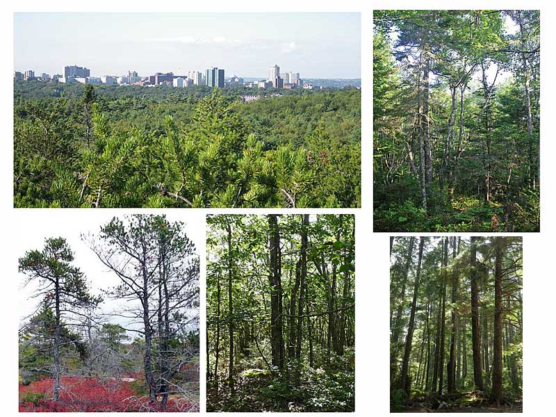
Forests in Halifax Regional Municipality Above left: Halifax viewed from a high point on granite outcrop in the Spryfield Area. There are jack pines in the foreground. Top right: mixed Acadian forest near Shad Bay (relatively low susceptibilty to fire). Bottom right: hemlock on the Woodens River; hemlock is an Acadian forest species with very low tolerance of fire. Bottom left: jack pine on high granite outcrop in the Spryfield Area (fire susceptible). Bottom middle: oak woodland on The Bluff Wilderness Hiking Trail, burned approximately 40 years ago. (Photos by David Patriquin) | 66
Forests and fire in HRM
Halifax is surrounded by forest, not farmlands as are most cities. Most of the areas where the city has expanded have been in typical mixed Acadian forest which has relatively low susceptibility to fire, More and more, however, there is pressure to build in what were once very challenging areas to build: the barrens and associated pockets of forest on high granitic outcrops. Indeed they can be exceptionally beautiful places to situate a residence. The first time I went into jack pine stands close to Halifax I was reminded of the lovely, quasi-open fire-prone Aleppo pine forests with shrubby understories at Kareas, a suburb on the hills overlooking Athens Greece, which I visited in the mid 1980s. In July of 1998, international news reports showed footage of a horrendous fire which swept through the area. The flames of the Spryfield fire, which I viewed from Halifax Peninsula on April 30th, 2009, presented very similar images.
The lovely oak woodlands found on drumlins and other dryish sites in Halifax Regional Municipality constitute another forest type that many researchers regard as fire dependent and even fire-stimulating.
|

HFN walk on the Purcells Cove Conservation Lands, June 26, 2009. (Photo by David Patriquin)
| 67
As in other places where people settle in areas of fire prone vegetation, we are faced with a dilemma: we want to prevent and/or put out fires quickly but by doing so, we allow the fuel load to increase, in turn increasing both the likelihood of fire and its intensity when it strikes.
|

(Photo by David Patriquin) | 68
So how do we address this issue in HRM? Landscape-specific building codes requiring extended buffer zones and use of fire resistant building materials in fire-prone landscapes may part of the answer. It's obviously important to retain whatever wetlands we have in these landscapes.
Personally, I think there should be significant restrictions on development in the areas of granite barrens and associated forest on the Chebucto Peninsula for public safety, to preserve the beauty and character that they add to our municipality, and for conservation of species, e.g.
- broom crowberry (a coastal plain species that is "apparently secure" in Nova Scotia, but imperiled elsewhere; it is declining in N.S. because of development and other pressures)
- goldenheather (imperilled)
- mountain sandwort (imperilled)
- a half dozen or more rare species found in the "permanent coastal barrens", as documented by Jeremy Lundholm and colleagues at Saint Mary's University
Contribution of private lands to conservation in the area (The Purcells Cove Conservation Lands) is an especially encouraging move in this direction. Let's hope there will be more! There are some big chunks of crown land in the area as well (see: The Herring Cove Backlands Wilderness Area). I do hope that these issues will be flagged in HRM's Urban Forest Management Plan, currently being developed.
|
|